Spacc BBS Spacc BBS
    • Categorie
    • Recenti
    • Tag
    • Popolare
    • Mondo
    • Utenti
    • Gruppi
    • Registrati
    • Accedi
    La nuova BBS è in fase Alpha. I post precedenti al 22 luglio 2024 potrebbero non essere trasferibili, ma rimarranno disponibili per la lettura su /old/.

    Do you need a physical or political map of the world?

    Pianificato Fissato Bloccato Spostato Uncategorized
    2 Post 2 Autori 5 Visualizzazioni
    Caricamento altri post
    • Da Vecchi a Nuovi
    • Da Nuovi a Vecchi
    • Più Voti
    Rispondi
    • Topic risposta
    Effettua l'accesso per rispondere
    Questa discussione è stata eliminata. Solo gli utenti con diritti di gestione possono vederla.
    • muffa@puntarella.partyM Questo utente è esterno a questo forum
      muffa@puntarella.party
      ultima modifica di

      Do you need a physical or political map of the world?

      👇 👇 👇

      Link Preview Image
      Equal Earth Wall Map - Home

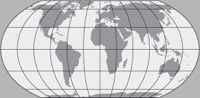
      A wall map in the Equal Earth projection showing countries of the world. The map is free of charge.

      favicon

      (equal-earth.com)

      • It’s free. Download the map and print as many copies as you want.

      • It’s big. The map measures 55” wide x 29” tall (1.4 x 0.74 meters). You can print it even larger thanks to the very high resolution.

      • Just enough detail. The 2,600+ map labels provide geographic context without overwhelming you with too much information.

      • Professional design. With pleasing colors, readable type, and clear visual hierarchies, this is a map that you will want to look at.

      angelastella@social.treehouse.systemsA 1 Risposta Ultima Risposta Rispondi Cita 1 0
      • gustavinobevilacqua@mastodon.cisti.orgG gustavinobevilacqua@mastodon.cisti.org shared this topic
      • angelastella@social.treehouse.systemsA Questo utente è esterno a questo forum
        angelastella@social.treehouse.systems @muffa@puntarella.party
        ultima modifica di

        @muffa

        Interesting. Downloaded the simplest, lightest one. We'll see how useful it proves.

        In the meantime, here are some Aitoff and Mercator world maps, Lambert azimuthal ones for continents, and of course a whole lot of maps of Argentina, all suitable for smaller paper sizes:

        Link Preview Image
        Mapas Escolares | Instituto Geográfico Nacional

        favicon

        (www.ign.gob.ar)

        Enjoy!

        1 Risposta Ultima Risposta Rispondi Cita 1 0
        • Primo post
          Ultimo post